
Page 38 - APICAL_SR2020
P. 38
SUSTAINABILITY REPORT 2020 01 02 03 04 05 06
Working with Suppliers
WORKING WITH
SUPPLIERS
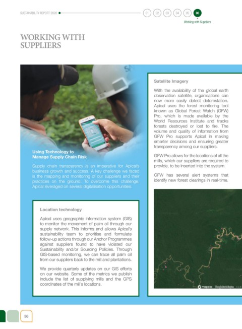
Satellite Imagery
With the availability of the global earth
observation satellite, organisations can
now more easily detect deforestation.
Apical uses the forest monitoring tool
known as Global Forest Watch (GFW)
Pro, which is made available by the
World Resources Institute and tracks
forests destroyed or lost to fire. The
volume and quality of information from
GFW Pro supports Apical in making
smarter decisions and ensuring greater
transparency among our suppliers.
Using Technology to
Manage Supply Chain Risk GFW Pro allows for the locations of all the
mills, which our suppliers are required to
Supply chain transparency is an imperative for Apical’s provide, to be inserted into the system.
business growth and success. A key challenge we faced
is the mapping and monitoring of our suppliers and their GFW has several alert systems that
practices on the ground. To overcome this challenge, identify new forest clearings in real-time.
Apical leveraged on several digitalisation opportunities.
Location technology
Apical uses geographic information system (GIS)
to monitor the movement of palm oil through our
supply network. This informs and allows Apical’s
sustainability team to prioritise and formulate
follow-up actions through our Anchor Programmes
against suppliers found to have violated our
Sustainability and/or Sourcing Policies. Through
GIS-based monitoring, we can trace all palm oil
from our suppliers back to the mill and plantations.
We provide quarterly updates on our GIS efforts
on our website. Some of the metrics we publish
include the list of supplying mills and the GPS
coordinates of the mill’s locations.
36